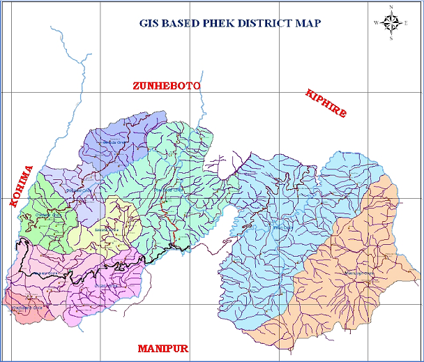
Phek is one of the seventeen districts of Nagaland and is home to the Chakhesang and Pochury tribes. Originally, it was a sub-division under Kohima district until its separation on December 19, 1973. The name "Phek" is derived from the word "Phekrekedze," meaning watchtower. The district is geographically located in the southeastern part of Nagaland, sharing boundaries with Myanmar (Burma) to the east, Manipur to the south, Kohima district to the west, and Zunheboto district to the north.
The district has a total area of 2,026 sq. km (202,600 ha), with about 70% of its land covered by thick evergreen forests. The altitude varies from 520 m (Lanyie) to 2,133 m (Pfutsero) above mean sea level. The climate is moderate, with warm summers and cold winters, and the monsoon season lasts from late May to September. It is also known for its rich biodiversity, with three major rivers, Tizu, Lanye, and Sedzu, and three significant lakes, Shilloi, Chida, and Dzudu.
According to the 2011 Census, the district has a total population of 163,418, with 83,743 males and 79,675 females. The population density is 81 people per sq. km, and the literacy rate stands at 78.05%. The district comprises 117 inhabited villages and is administratively divided into five Rural Development Blocks, namely Sekruzu, Phek, Meluri, Kikruma, and Pfutsero. The district headquarters, Phek town, is located 145 km from Kohima, the state capital.
Agro-Ecological Situations (AESs) and Agriculture
Phek district is divided into two Agro-Ecological Situations (AESs) based on altitude, rainfall, and soil conditions.
- AES-I covers the Phek and Kikruma blocks, with an altitude ranging from 900 to 1500 meters above sea level and annual rainfall exceeding 1000 mm. The soil is sandy loam to fine loamy, rich in humus. Major crops grown in this zone include paddy, maize, potato, temperate fruits, kholar (beans), soybean, floriculture, and forestry. Livestock rearing and paddy-cum-fish culture are also common in this zone.
- AES-II includes Pfutsero, Meluri, and Sekruzu blocks, where the altitude varies from 1500 to 3000 meters above sea level and annual rainfall exceeds 1500 mm. The soil type is sandy to clay loam, and major agricultural activities include paddy, maize, ginger, banana, chilly, rice bean, and passion fruit cultivation. In addition, piggery, cattle rearing, mithun (a semi-domesticated bovine species), and poultry farming are widespread in this zone.
Due to the hilly terrain, farming practices in this are highly dependent on the slope of the land. Steep hills and high-altitude areas are often utilized for orchards and plantation crops, while mid-hill slopes (50-100%) are used for jhum cultivation. The lower hill slopes (20-50%) are ideal for paddy cultivation, including the paddy-cum-fish culture system, which is gradually expanding.
Traditional farming systems such as jhum cultivation remain dominant due to the lack of sufficient water for terrace farming. However, in Kikruma block, the Zabo system (also known as Ruza), a water-harvesting-based farming method, is practiced.
Major Agricultural and Horticultural Produce
Paddy is the dominant crop, grown using both wet terrace rice cultivation (WTRC) and jhum methods. According to the Nagaland Statistics Report 2023, the total area under WTRC is 15,382 ha, yielding 47,970 metric tons (MT) of rice annually. Maize is cultivated over 5,711 ha, producing 11,439 MT, while jhum paddy occupies 2,173 ha, generating 4,292 MT. Additionally, millet is cultivated on 964 ha.Other major crops include cabbage, kiwi, cauliflower, large cardamom, ginger, passion fruit, plum, peach, pear, and apple.
Irrigation and Soil Profile
The total area under irrigation in Phek district is 15,450 ha, with an irrigation potential of 20,000 ha. The district has five major soil types, each contributing to different cropping systems:Black soil(36,468 ha), Red soil(24,312 ha), Alluvial soil (18,234 ha), Sandy soil (6,078 ha), Red laterite soil (117,508 ha)
Livestock and Fisheries
The district has a significant livestock population, with farmers rearing pigs (both crossbreed and indigenous varieties), Mithun, poultry, rabbits, and goats. The total fish production is recorded at 386.00 million tons, indicating a growing potential for inland fisheries.
Forest Resources and Biodiversity
District has extensive forest coverage, accounting for 1,593.69 sq. km of land. The forests are home to a diverse range of flora and fauna, many water springs, supporting both ecological balance and economic activities such as timber collection and non-timber forest produce gathering.
